| Miles Kms | Item | Summary |
|---|---|---|
| 0.0 0.0 |
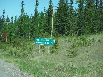
Junction of Highway #16 The Yellow Head Route |
East to Vanderhoof, B.C. - Prince George B.C. West to Fraser Lake,BC - Burns Lake,BC - Smithers,BC - Terrace B.C. - Prince Rupert, B.C. |
| 0.8 1.3 |
View from highway |
Driving north to Fort St. James, BC. |
| 1.0 1.6 |
Quail Road |
|
| 2.2 3.5 |
View from highway |
Driving north to Fort St. James.
|
| 2.5 4.0 |
Point of Information |
Crossing the Nechako River, BC. |
| 7.5 12.0 |
Blue Mountain Road |
East side of highway. |
| 8.2 13.2 |
Geermaert Road |
West side of highway. |
| 8.5 13.6 |
Point of Information |
Crossing Yamerak Creek. |
| 9.1 14.7 |
Fourteen Mile Road |
East side of highway. |
| 10.6 17.1 |
Blue Mountain Road |
East side of highway. |
| 11.4 18.4 |
View from highway |
Driving north to Fort St. James,BC.
|
| 21.4 34.4 |
Kenner Road |
East side of highway. |
| 27.5 44.3 |
Welcome to the community of Fort St James - Southern limits |
Fort St. James was originally established by the explorer Simon Fraser for the North West Company in 1806. |
| 27.6 44.4 |
Junction Roads |
Frost Road to the West. Airport Road and Morgan Road to the East. |
| 29.5 47.5 |
Airport Road |
Quickest access to Fort St. James Airport. |
| 30.0 48.2 |
Hanley Road |
West side of highway. |
| 30.4 48.9 |
Point of Information |
Crossing Jottahamma Creek. |
| 30.5 49.1 |
Access to Fort St. James Snowmobile Club |
West side of highway. |
| 30.6 49.2 |
Sowchea Bay Road - Access to Paarens Beach Provincial Park & Sowchea Bay Provincial Park |
West of highway. Paarens Beach Provincial Park Campground has 36 campsites has a picnic table and firering also a R.V. dump station. A large day-use/picnic area is located on a lengthy stretch of wide sandy beach. Change houses, abundant picnic tables, a playground for the kids and a log picnic shelter are all available.
- Sowchea Bay Provincial Park Campground This park offers 30 smaller vehicle accessible campsites. There is no day-use area at Sowchea Bay Provincial Park (use facilities at Paarens Beach Provincial Park, just 5 km east on Sowchea Bay Road). This campsite was once a Forest Service recreation site. |
| 31.3 50.4 |
Point of Information |
Crossing the Stuart River, BC - Photo looking east at the Stuart River, BC. |
| 31.4 50.6 |
Roberts Road |
Access to campground, east side of highway. |
| 31.5 50.7 |
Garvie Road |
West side of highway. |
| 32.4 52.2 |
Necoslie Road |
|
| 32.5 52.3 |
Services fuel at highway |
East side of highway, gas and diesel |
| 32.9 52.9 |
Fort St. James, BC and National Historic Site |
Access to Fort St. James National Historic Site, B.C., a restored Hudsons Bay Company post on the southern shores of Stuart Lake in the interior of British Columbia. It was the center of trade and commerce in the 19th century fur trade. Simon Fraser originally established the fort in 1806 for the North West Company. It has the largest number of original wooden buildings representing Canada's fur trade. The story is about the relationships and interactions among the fur traders and Native Peoples of the region, namely the Carrier First Nations.
Start / Finish of Road Map Highway Travel Guide -e
|