| Miles Kms | Item | Summary |
|---|---|---|
| 0.0 0.0 2575 ft. |
Highway #16, Town of Entwistle, Alberta |
The Yellowhead Route. East to Edmonton, Alberta
, west to Hinton, Alberta
, Alaska Highway, Jasper, Jasper, Alberta
National Park. South to Drayton Valley, Alberta
, Rocky Mountain House, Alberta
Sundre, Alberta. Attraction along The Cowboy Trail: Bar U Ranch - Calgary Stampede - Glenbow Museum - Head-Smashed-In Buffalo Jump - Kootenai Brown Pioneer Village - Remington Carriage Museum - Sundre Pioneer Village Museum - Rocky Mtn House NHSC - Caroline Wheels of Time Museum - Cowboy Trail Church - Em-Te-Town - Great Canadian Barn Dance and Family Campground - Leighton Art Centre Museum & Gallery - Millarville Farmerse Market - Nordegg Heritage Centre & Industrial Museum.
|
| 0.2 0.4 2592 ft. |
View from highway |
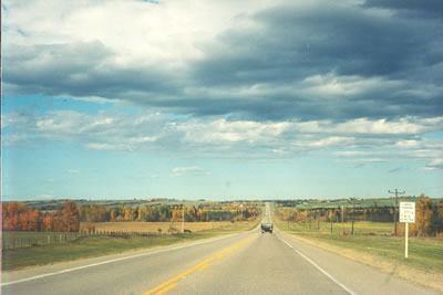
Driving south on the Cowboy Trail. |
| 0.2 0.4 2575 ft. |
Junction of Highway #16, Town of Entwistle, Alberta  |
Photo of highway direction sign, with clear blue skies |
| 1.3 2.1 2608 ft. |
Buear River Park |
Access to Park 3 km's |
| 4.9 7.9 2651 ft. |
Hoople Lake , AB |
East of highway |
| 11.4 18.4 2710 ft. |
Township Road # 514 |
Milbank Road |
| 13.8 22.2 2910 ft. |
Township Road 512 |
West to Bigoray, AB, Natural Area |
| 15.5 24.9 2690 ft. |
Junction of Highway # 624 |
East to Tomahawk, Alberta, 18 km's |
| 21.6 34.7 2838 ft. |
Junction of Highway # 621 |
West access to Town of Cynthia, Alberta, east to Rocky Rapids, Alberta, Easy Creek Natural Area 13 km's west |
| 23.0 37.0 2812 ft. |
Rocky Rapids Natural Area, AB |
West of highway |
| 23.1 37.1 2762 ft. |
Pih Twe Kwe Campsite |
West of highway |
| 23.6 37.9 2805 ft. |
Township Road # 494 |
Access to Drayton Valley Campground R V park, cross countjavascript:void(0)ry skiing. East access to Eagle Point Alberta Provincial Park. |
| 24.4 39.2 2805 ft. |
View from Highway |
Photo of highway 22 marker sign. Cloudy skies with wheat field in background |
| 24.9 40.1 2841 ft. |
Drayton Valley, AB |
Access east side of highway, 18 hole golf course |
| 25.7 41.4 2608 ft. |
Access to Town of Drayton Valley, Alberta |
Drayton Valley, Alberta, all services. Information Direction Center. Attractions Drayton Valley’s museum, Farmers’ Market every Wednesday, Kinsmen Performing Arts Festivalin spring, Drayton Valley Bench Fair |
| 25.9 41.6 2703 ft. |
Junction of Highway # 492 |
Services at highway, fuel |
| 27.3 43.9 2474 ft. |
Junction of Highway |
West to Brazeau Dam, Alberta , Lodgepole, Alberta. |
| 27.3 43.9 2448 ft. |
Township Road # 491 |
Access to Drayton Valley, Alberta. |
| 28.3 45.5 2598 ft. |
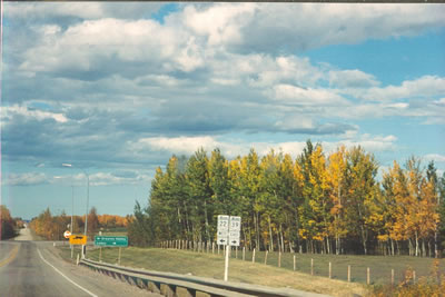
View from Highway - Photo Drayton Valley, Alberta, highway sign |
Driving south on the Cowboy Trail. |
| 28.9 46.5 2733 ft. |
50th Street |
North to Drayton Valley Park |
| 29.5 47.4 2697 ft. |
Photo |
Fall colored tree leaves with oil tanker truck, cloudy sky |
| 30.9 49.8 2710 ft. |
Photo |
Curve of highway with vehicle traffic and fall tree leaves |
| 31.4 50.6 2680 ft. |
Point of Interest |
Crossing The North Saskatchewan River |
| 32.7 52.7 2753 ft. |
Range Road # 71 |
Access to Willly West Campground R V park, Full Hookups. West to Buck Lake, Alberta. |
| 33.9 54.5 2792 ft. |
Junction of Highway # 39 |
East to Luduc, Alberta, Edmonton, Alberta. |
| 34.7 55.9 2792 ft. |
Photo |
Highway marker sign showing highway 19 junction |
| 35.4 57.0 2831 ft. |
Point of Information |
Crossing Jottahamma Creek. |
| 38.0 61.2 2835 ft. |
Range Road # 484 |
West to Blue Rapids Alberta Provincial Recreation Area, Pembina Field Natural Area, AB . East to Buck Lake Creel Alberta natural Area |
| 42.0 67.6 2920 ft. |
Junction of Highway # 616 secondary |
Services at highway junction,Fuel, west to Buck Creek, Alberta. |
| 44.1 70.9 2874 ft. |
Township Road 474 |
west to Washout Saskatchewan Alberta Natural Area. |
| 50.1 80.7 3002 ft. |
Township Road 464 |
West to Washout Creek Alberta Natural Area |
| 52.2 84.0 3094 ft. |
Range Road # 462 |
|
| 54.2 87.2 3196 ft. |
Em-Te-Town, Alberta |
Access to Em-Te-Town, 10km's west, campground |
| 54.2 87.2 3219 ft. |
Junction of Highway #13 |
East to Pigeon Lake Provincial Park, camping. East to Pigeon Lake, Alberta, Westerose, Alberta, Wetaskiwin, Alberta. West to Buck Lake Provincial Recreation Area, camping |
| 57.2 92.1 3212 ft. |
Range Road 70A |
West access to Horseshoe Creek Alberta Natural Area |
| 58.2 93.7 3192 ft. |
Fairways West Golf Course |
Access east side of highway, 18 hole couse |
| 62.3 100.3 3156 ft. |
Medicine Lake Road |
Access to Medicine Lake Campground, 5 km's west |
| 70.9 114.1 3606 ft. |
Junction of Highway # 53 |
East to Rimbey, Alberta, Ponoka, Alberta. East to Open Creek Alberta Natural Area |
| 77.1 124.0 3291 ft. |
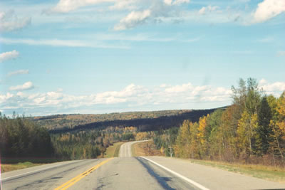
Photo |
Driving south on the Cowboy Trail. Curve in highway colored tree leaves and partial cloudy skies |
| 82.3 132.4 3150 ft. |
Photo |
Driving south on the Cowboy Trail.Blue skies and trees turning in fall. |
| 86.5 139.2 3150 ft. |
Mill Island Alberta Natural Area |
West of highway |
| 87.4 140.6 3261 ft. |
Cameron Creek Golf Course |
Access to Golf Course |
| 87.5 140.8 3261 ft. |
Junction of Highway #12 |
Highway # 12 east to Bentley, Alberta., Lacombe, Alberta. |
| 91.0 146.5 3241 ft. |
View from highway |
Driving south on the Alberta, Cowboy Trail. |
| 91.6 147.4 3274 ft. |
Junction of Highway #11 and # 22 |
Highway #11 The David Thompson Highway, west to Nordegg, Alberta. The Ice Fields Parkway, Alberta., Banff National Park, Alberta., Jasper National Park, Alberta. West to Crimson Lake Alberta Provincial Park, Camping, boating, fishing, hiking. |
| 93.1 149.9 3301 ft. |
Town of Rocky Mountain House, Alberta. |
All services, Visitor Information Directions Museum, (no charge) west side of highway. Caikawa Drive, Access west to Aspen Park Campground. Attractions in and around Rocky Mountain House, Alberta. - Rocky Mountain House Museum - Brigade Days - e David Thompson Days Country Fair - Rocky Mountain House National Historic Site. |
| 93.8 151.0 3297 ft. |
Junction of Highway #598, #11a |
West to Rocky Mountain National Historic Site. Over 200 years ago the North West and Hudsones Bay companies set up rival posts at the end of the fur trade line on the North Saskatchewan River. Interpretive presentations, exhibit tours, and self-guided trails. |
| 93.8 151.0 3330 ft. |
Junction of Highway # 752 |
West to Cow Lake Recreation Area, camping |
| 94.1 151.4 3284 ft. |
Access to Rocky Mountain House, Alberta - Downtown business Area |
West access |
| 97.6 157.1 3258 ft. |
Junction of Highway # 11 #22 |
East to Red Deer, Alberta, south to Sundre, Alberta. |
| 99.1 159.4 3258 ft. |
View from Highway |
Photo of highway marker sign, junction of highway, trees |
| 103.6 166.7 3373 ft. |
Point of Interest |
Bridge crossing Clearwater River, Alberta. |
| 112.3 180.7 3527 ft. |
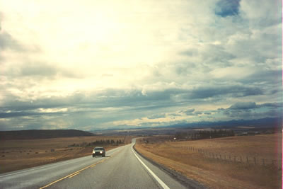
View from Highway |
Driving south on the Alberta, Cowboy Trail |
| 114.6 184.5 3524 ft. |
Junction of Highway # 54 # 591 |
East to Caroline, Alberta, Innisfail, Alberta. West to recreation area. |
| 114.6 184.5 3543 ft. |
Clearwater Trading Co. Campground, AB |
Camping, cabin rentals. |
| 114.8 184.7 3527 ft. |
Point of Interest |
Bridge crossing The Clearwater River, Alberta. |
| 119.2 191.8 3451 ft. |
Burntstick Lake, Alberta |
Access Burntstick Road, 14km's |
| 119.5 192.3 3481 ft. |
Entering Caroline, Alberta. |
All services. Attractons in Caroline, Alberta: Caroline Wheels of Time Museum. |
| 119.8 192.8 3481 ft. |
Kurt Browning Arena, Caroline, Alberta |
Access south side of highway |
| 119.9 193.0 3425 ft. |
View from Highway - Photo Welcome to Caroline, Alberta,highway sign  |
Driving south on the Alberta, Cowboy Trail |
| 120.3 193.6 3412 ft. |
Caroline, Alberta Municipal Campground |
Municipal Campground, 19 sites, 8 unserviced, showers |
| 122.8 197.6 3491 ft. |
Junction of Highway #54 # 22 |
East to Innisfail, Alberta. |
| 122.8 197.6 3497 ft. |
Roadside Highway Turnout |
Access west side of highway |
| 127.3 204.9 3806 ft. |
Township Road 354 |
Access to Burntstick Lake, Alberta, west side of highway. |
| 133.4 214.7 3684 ft. |
Junction of Highway# 547 |
East to Boden, Alberta. |
| 133.4 214.7 3632 ft. |
Junction |
Highway 587 east of highway, Township Road 344 west of highway. |
| 134.6 216.6 3691 ft. |
Point of Interest |
Bridge crossing creek |
| 135.0 217.2 3684 ft. |
View from Highway |
Driving south on the Alberta, Cowboy Trail |
| 135.4 217.9 3675 ft. |
Point of Interest |
Mountainview, Alberta, County Boundry |
| 135.8 218.5 3675 ft. |
View from Highway |
Driving south on the Alberta, Cowboy Trail. |
| 143.6 231.1 3711 ft. |
Junction of Highway # 27 #584 |
Access to Drivings West R V park, 1km west, Bearberry Nordic Center, 34 km's west, Mukwah Tours White Water Rafting, 60km's west |
| 144.4 232.3 3720 ft. |
Entering The Town of Sundre, Alberta |
All services, Attractions in Sundre, Alberta: Sundre Pioneer Village Museum. |
| 144.6 232.7 3743 ft. |
Sundre Pioneer Museum |
Access to museum |
| 145.0 233.4 3727 ft. |
Junction of Highway #760 |
South to Bergen, Alberta. |
| 145.1 233.5 3720 ft. |
Visitor Information Direction Center |
East side of highway |
| 145.3 233.8 3691 ft. |
Tall Timbers R V Park , AB |
Access east side of highway, 360 seasonal sites,60 overnite sites, full hookups |
| 146.0 235.0 3652 ft. |
Sundre Golf Club |
Access east side of highway |
| 151.3 243.5 3655 ft. |
Junction of Highway # 27 |
East to Olds, Alberta. Attractions in and around Ols, Alberta: Mountain View Museum - The Olds College Alumni Museum - Mayfair Cinema. |
| 151.4 243.6 3586 ft. |
Services at Highway |
East side of highway |
| 157.0 252.6 3661 ft. |
Township Road # 320 |
Access to Bergen, Alberta, 9km's west. |
| 158.7 255.4 3757 ft. |
Junction of Highway #582 |
East to Didsbury, Alberta. |
| 160.0 257.5 3832 ft. |
View from Highway |
Driving south on the Alberta, Cowboy Trail. |
| 168.2 270.7 4016 ft. |
Entering the Village of Cremona, Alberta - Junction of Highway # 580 |
All services 580 east to Carstairs, Alberta. Attractions in and around Carstairs, Alberta: Custom Woolen Mills - Roulston Museum - PaSu Farm. |
| 168.7 271.5 4019 ft. |
View from Highway - Photo Cowboy Trail Highway Sign |
Driving south on the Alberta, Cowboy Trail. |
| 169.6 272.9 4019 ft. |
Roadside Highway Turnout |
West side of highway |
| 171.1 275.4 3957 ft. |
Juction of Highway # 517 |
County of Mountain View, Alberta, west to Water Valley, Alberta. West Valley R V Park, Water Valley Golf Course 13 km's west |
| 171.4 275.8 3947 ft. |
View from Highway |
Driving south on the Alberta, Cowboy Trail. |
| 177.6 285.8 4219 ft. |
Junction of Highway # 574 |
East to Madden, Alberta, west to Bottrell, Alberta. |
| 181.6 292.3 4327 ft. |
Triple Diamond R V Park |
Acces to R V Park, 13 km's west |
| 187.7 302.1 3986 ft. |
View from Highway |
Driving south on the Alberta, Cowboy Trail. |
| 187.8 302.2 4268 ft. |
Junction of Highway # 567 |
East to Airdie, Big Hill Springs Alberta Provincial Park, camping, recreation 7km's |
| 188.0 302.6 3901 ft. |
Point of Information |
Crossing Yamerak Creek. |
| 192.1 309.2 3760 ft. |
View from Highway |
Driving south on the Alberta, Cowboy Trail. |
| 192.6 309.9 3802 ft. |
Western Heritage Center, Cochrane, Alberta |
Cowboy Ranch Rodeo Interpretive Center, 1km east |
| 193.0 310.6 3868 ft. |
Entering Cochrane, Alberta - Highway Junction #1a |
All services. Highway 1a The Bow Valley Trail, east to Cochrane, Alberta, town center, west to Canmore,Alberta,Banff, Alberta, Banff, Alberta National Park. Attractions in and around Cochrane, Alberta: Alberta historic site, Cochrane Ranche, Alberta - Westlands Art Gallery - Rustica Art Gallery - Studio West Bronze Foundry & Art Gallery. |
| 193.4 311.3 3927 ft. |
Quigley Drive |
Services |
| 194.0 312.2 3937 ft. |
Griffen Road |
Access to Campgrounds, golf course |
| 194.2 312.5 3924 ft. |
Point of Interest |
Crossing the Bow River, Alberta. |
| 197.7 318.2 4065 ft. |
Access to Airport |
Airport access |
| 198.0 318.7 4065 ft. |
View from Highway |
Driving south on the Alberta, Cowboy Trail. |
| 198.4 319.2 4065 ft. |
View from Highway |
Highway #1 The Trans Canada Highway.
|
| 198.6 319.6 4065 ft. |
Junction of Highway #1 The Trans Canada Highway |
East to Calgary, Alberta, West to Canmore, Alberta, Banff, Alberta, Banff, Alberta, Jasper, Alberta, National Park, south to Okotoks, Alberta,, north to Cochrane, Alberta, Rocky Mountain House, Alberta.
Start / Finish of Road Map Highway Travel Guide. NOTE For highway travel via The Trans Canada Highway see Milebymile.com Road map Highway Travel Guide Alberta #1
Trans Canada Highway
BC/AB Border to Calgary, for driving directions / highway photos -e
|