| Miles Kms | Item | Summary |
|---|---|---|
| 0.0 0.0 |
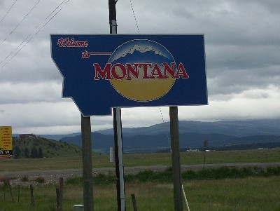
Welcome to Montana - Divide Exit # 102 on I-15 |
This drive starts at the small community of Divide which is named for the town's proximity to the Continental Divide. North access via, Interstate # 15 to cities of Butte, Montana, Helena, Montana, Great Falls, Montana. |
| 15.6 25.1 |
State Highway #43 |
Most of this drive is through the beautiful Big Hole Valley. |
| 19.7 31.7 |
Dickie Bridge Recreation Area |
Road crosses Big Hole River. |
| 20.8 33.5 |
East Bank Recreation Area |
|
| 21.8 35.1 |
Big Hole River, Montana |
The Big Hole River parallels the highway throughout most of this stretch. |
| 23.4 37.7 |
Turn-off to Anaconda, Montana |
Turn north here to follow gravel road NE to Anaconda. The Continental Divide passes within a few miles of Anaconda city limits and Rocky Mountain peaks reach 10,379 feet. |
| 26.0 41.8 |
East Fork Forest Service campground |
|
| 29.1 46.8 |
Fish Trap fishing access site |
|
| 36.0 57.9 |
Big Hole River |
The river crosses the highway at this point |
| 48.8 78.5 |
Big Hole Valley |
At this point the Big Hole River meanders through the valley. The Pintlar Mountain Range can be seen in the distance. |
| 51.3 82.6 |
Town of Wisdom, Montana |
Gas, food and lodging |
| 51.9 83.5 |
Junction County Highway 278 |
Stay on Highway 43 headed west. |
| 52.2 84.0 |
Big Hole River crosses highway |
|
| 55.7 89.6 |
Gibbonsville Road to Big Hole Pass |
This is an unimproved gravel road which crosses over the pass and rejoins Highway 43. Recommend high clearance and 4-wheel drive. |
| 62.0 99.8 |
Big Hole Battlefield, Montana |
This historic battlefield is the site of one of the first engagements between Chief Joseph and the Nez Perce and the U.S. Army. |
| 64.2 103.3 |
Enter Beaverhead National Forest |
This largest of the national forests in Montana covers 3.32 million acres, and lies in eight Southwest Montana counties (Granite, Powell, Jefferson, Deer Lodge, Silver Bow, Madison, Gallatin and Beaverhead). The Continental Divide National Scenic Trail and Nez Perce Historic Trail pass through the forest. |
| 66.1 106.4 |
Gibbons Camp historical marker |
|
| 69.8 112.3 |
May Creek Forest Service campground |
|
| 71.5 115.1 |
Trail Creek Road |
|
| 74.8 120.4 |
Approaching Chief Joseph Pass, Montana |
|
| 78.1 125.7 |
Chief Joseph Pass |
|
| 79.1 127.3 |
Junction U.S. Highway 93 |
This is the end of this drive. South access to Salmon, Idaho, North access to Missoula, Montana. South access to Lost Trail Pass, Lost Trail Pass Ski Area, and Idaho border. For continuance of highway travel north via Montana U S Highway # 93 see Milebymile Highway U. S. # 93 Travel Guide Idaho / Montana State Line to City of Missoula. - St-e
|