| Miles Kms | Item | Summary |
|---|---|---|
| 0.0 0.0 |
Exit #337 Junction of Highway #279 |
West to Levis, Trois-Rivieres, Montreal. East to Riviere-du-Loup. North to Quebec City. |
| 4.3 7.0 |
Exit #330 - Access to Camping Transit R V Park |
Access to Campground Transit, R V Park, full hookups elec. and non elec. sites, south of highway.
|
| 6.2 10.0 |
Exit #327 - Junction of Highways #173 & #277 |
North to town of Levis. All services, north to Ferry Terminal which joins Levis with Quebec City. South to communities of Saint-Henri, Sainte-Claire |
| 6.2 10.0 |
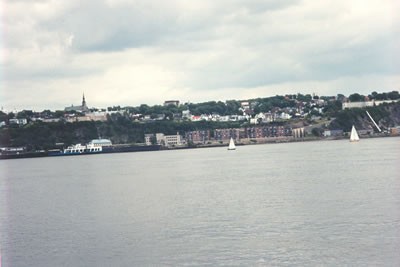
Point of Interest (Photo looking at skyline of Levis from ferry crossing the River Saint-Laurent) |
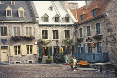
Mile by mile visited Quebec City via the ferry from Levis. This is an excellant way to go, rather than driving over the bridge west of Levis and trying to find a parking spot in a rather congested area. For a few dollars one can park your vehicle in the terminal parking lot and cross the ferry as a walk on passenger, the ferry stops at the oldest part of Quebec City (easy walking distance)
|
| 6.2 10.0 |
 |
Photo. Old Quebec City, tourist area not far from ferry terminal to Levis |
| 6.2 10.0 |
 |
Photo. Old Quebec City, tourist area not far from ferry terminal to Levis.
|
| 7.9 12.7 |
Exit #325 |
Access to highways #173 & #277. North to town of Levis. |
| 9.2 14.8 |
Point of Interest |
Crossing the Riviere Gescouture. |
| 10.1 16.3 |
Exit #321 |
|
| 11.8 19.0 |
Point of Interest |
Crossing the Riviere Etchemin. |
| 12.4 20.0 |
Exit #318 |
Access to highway #275. North to community of Saint Romuald. South to community of Saint-Jean-Chrysostome. |
| 14.0 22.6 |
Truck Weigh Scales |
North side of highway |
| 14.4 23.1 |
Exit # 314 |
Junction of highways #73 & #175. North to Quebec City. |
| 16.5 26.5 |
Exit #311 |
North to community of Saint-Nicolas |
| 20.2 32.5 |
Exit #305 _ Junction of Highway #171 |
South to community of Sainte-Marie |
| 23.2 37.3 |
Roadside Highway Turnout Rest Area |
Provincial rest area, north side of highway. |
| 26.1 42.0 |
Exit #296 |
Access to Domaine de la chute Campground. |
| 29.7 47.8 |
Exit #291- Junction of Highway #273 |
South to community of Saint-Agapit. North to community of Francoeur. |
| 33.4 53.8 |
Exit #285 |
|
| 37.5 60.4 |
Exit #278 - Junction of Highway #278 |
North to community of Sainte-Croix. South to communities of Laurier-Station, Dosquet. |
| 41.8 67.3 |
Exit #271 |
South to communities of St-Janvier-De-Joly, Fortier. |
| 45.1 72.5 |
Exit #266 |
|
| 45.7 73.6 |
Point of Interest |
Crossing the Riviere Henri. |
| 48.1 77.4 |
Exit #261 |
Services at highway. Community of Riviere-Henri. South to community of Fourches. |
| 48.2 77.6 |
Point of Interest |
Crossing the Riviere du-Chene |
| 51.7 83.2 |
Exit #256 |
|
| 52.5 84.5 |
Roadside Highway Turnout Rest Area |
Both sides of highway. Provincial rest area, picnic tables toilets. |
| 59.5 95.8 |
Exit #243 - Junction of Highway #218 |
North to communities of St. Joseph-De-Blandford, Savole, |
| 65.1 104.8 |
Exit #235 - Junction of Highways #263 & #162 #165 |
South to communities of Plessisville, Princeville. North to Communities of Lemieux, Ste-Marie-De-Blandford |
| 67.9 109.2 |
Point of Interest |
Crossing the Riviere Becancour. |
| 69.1 111.2 |
Exit 228- Junction of Highway #165 |
Access to Domaine-Paquet |
| 71.5 115.0 |
Roadside Highway Turnout Rest Area |
North side of highway. Provincial Rest Area, picnic tables, toilets. |
| 74.2 119.4 |
Roadside Highway Turnout Rest Area |
South side of highway. Provincial rest area, picnic tables, toilets |
| 74.3 119.6 |
Exit #220 _ Junction of Highway #261 |
North to communities of Ste-Anne-Du-Sault, Daveluyville, Becancour. North to campground. |
| 77.9 125.4 |
Exit #215 |
|
| 81.2 130.7 |
Exit #210 - Junction of Highways #161 # 955 |
North to city of Trois-Rivieres. South to community of Victoriaville. West to city of Montreal. West to Quebec city. Start / Finish of Highway Travel Guide. |