| Miles Kms | Item | Summary |
|---|---|---|
| 0.0 0.0 |
Exit #110 - City of Ellensburg |
Junction of highway #97 & Interstate #90. North to Wenatchee. East to Olmstead Place State Park, a 217-acre day-use park that features a working pioneer farm. Tours and school field trips are offered at the park. There are many pioneer artifacts and many of them are still in use in maintaining the farm. Picnic space and walking trails interweave with interpretive activities |
| 2.4 3.8 |
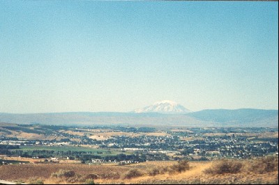
View from highway |
Driving south |
| 2.6 4.2 |
Exit # 3 ( Thrall Road ) Junction of highway #821 |
South to community of Umptanum |
| 7.3 11.7 |
Roadside highway turnout with viewpoint |
West side of highway |
| 11.4 18.3 |
Exit # 11 ( Military Area Road ) |
|
| 13.3 21.4 |
Exit # 44 |
Access to community of Wapato, south of highway |
| 17.5 28.2 |
Point of Interest |
Umtanum Ridge elev. 2315 ft. |
| 19.9 32.0 |
Point of Interest |
Yakima County northern boundry |
| 23.5 37.8 |
View from highway ( city of Yakima in distance |
Driving south |
| 27.0 43.5 |
Exit # 26 ( Canyon Road ) Junction of highway # 821 |
West to community of Selah. North to community of Umtanum |
| 29.5 47.5 |
Exit # 29 ( East Selah Road ) |
|
| 31.1 50.0 |
Exit #30 ( Rest Haven Road ) Junction of highway # 823 |
West to community of Selah |
| 31.4 50.6 |
Point of Interest |
Crossing the Yakima River |
| 32.3 51.9 |
Junction of highway #12 City of Yakima |
West to community of Gleed, Naches, NOTE highway #12 overlaps highways #97 & Interstate #82 at this point south
|
| 33.3 53.6 |
Exit # 33a Fair Ave & Lincoln Road |
|
| 33.8 54.4 |
Exit #33b |
Access to Convention Centre, Yakima Ave, Terrace Hts. |
| 35.2 56.7 |
Exit #34 Junction of highway #24e |
East to community of Moxee. Access to Yakima Sportsman State Park, a 247-acre camping park created in 1940 by the Yakima Sportsman's Association for the promotion of game management and the preservation of natural resources. The park is on the floodplain of the Yakima River and is an irrigated 'green zone' in an otherwise desert area. A variety of deciduous trees inside the park provide shade for the camping and picnic areas. There are about 140 bird species that have been identified in the park. Ponds lure fishers to the river. The park is a well-liked spot for travelers and visitors to stay over to attend events in the Yakima area. The park has 28 tent spaces, 37 utility spaces, one dump station, two restrooms (both ADA) and four showers (all ADA). Utility sites 1 through 16 are 60 feet long
|
| 36.8 59.2 |
Exit # 36 ( Union Gap and Valley Blvd. ) |
|
| 38.5 61.9 |
Exit #37 Junction of highway # 97 |
NOTE Highway # 97 overlap leaves highway # 12 & Interstate highway 82 at this point south. |
| 39.3 63.2 |
Point of Interest |
Crossing the Yakima River |
| 39.8 64.1 |
View from highway |
Driving east |
| 45.2 72.8 |
Exit # 44 |
Access to community of Wapato, south of highway |
| 48.8 78.5 |
View from highway - photo Yakima River |
Driving east |
| 51.0 82.1 |
Exit # 50 Junction of highway # 22 |
Access to community of Buena. South to highway # 97, south to community of Toppenish |
| 53.0 85.3 |
Exit # 52 |
|
| 55.1 88.6 |
Exit # 54 |
Access to community of Zillah, Yakima Valley Highway. |
| 59.6 95.9 |
Exit # 58 |
Access to community of Granger, access to highway # 223 |
| 66.3 106.7 |
Exit # 63 |
Community of Sunnyside, North to community of Outlook. Access to lodging, campgrounds |
| 68.2 109.7 |
Exit # 67 |
|
| 70.2 112.9 |
Exit # 69 - Junction of highway # 241 |
South to community of Alderdale
|
| 74.1 119.3 |
Exit # 73 |
Community of Grandview, south side of highway |
| 76.4 123.0 |
Exit # 75 |
County Line Road |
| 77.1 124.0 |
Point of Interest |
Benton Highway, west boundary |
| 81.3 130.9 |
Exit # 80 - Gap Road |
|
| 82.1 132.1 |
Roadside highway turnout rest area |
Telephone, toilets, picnic tables. |
| 84.6 136.1 |
Point of Interest |
Crossing the Yakima River |
| 84.8 136.4 |
Exit # 82 Junction of highways # 22 & highway # 221 |
South to community of Prosser, WA, Paterson, WA. There is a very nice rest area on I-82. Besides a rest area there are gas stations and various food options available at this exit and many places to eat are within walking distance of the rest area. The rest area has a pet area, dump station and fresh potable water available. |
| 88.2 141.9 |
View from highway |
Driving east |
| 88.2 142.0 |
Roadside highway turnout |
South side of highway, gravel turnout |
| 88.4 142.3 |
View from highway |
Driving east |
| 91.2 146.8 |
Exit # 88 - Gibbon Road |
|
| 96.4 155.1 |
Exit # 93 - Yakitat Road |
|
| 97.2 156.4 |
Exit # 96 - Junction of highways # 224e, # 225n. |
Access via highway # 224 to communities of W. Richland and Benton City. Access to R V Park north side of highway
|
| 101.8 163.8 |
Access to campground & R V Park |
North side of highway |
| 105.6 169.9 |
Exit # 102 - Junction of Interstate # 82 highway |
East to Tri - Cities of Richland, Pasco, Kennewick. NOTE Interstate highway # 82 leaves overlap of highway #12 and heads south to Washington /Oregon state border. |
| 117.6 189.3 |
Exit # 13 |
Access to city centre |
| 125.2 201.5 |
Exit # 109 |
|
| 130.2 209.5 |
Exit # 113 - Junction of highway #395 |
North to Tri Cities of Kennewick, Pasco, Richland. NOTE highway #395 overlaps Interstate # 82 at this point south. |
| 130.2 209.5 |
Point of Interest |
Interstate # 82 joins The Lewis and Clark Trail Scenic Byway |
| 133.4 214.6 |
Exit # 14 |
|
| 141.3 227.4 |
Exit # 122 |
|
| 147.4 237.2 |
Junction of highway # 14 |
West to city of Vancouver. NOTE The Lewis And Clark Trail Scenic Byway leaves I 82 at this point and heads west. |
| 149.0 239.8 |
Washington / Oregon State Border |
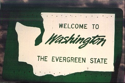
South to Oregon cities of Umatilla, Hermiston. Start / Finish of Interstate # 82 Travel Log |