| Miles Kms | Item | Summary |
|---|---|---|
| 0.0 0.0 |
Alberta / British Columbia Border |
Welcome to British Columbia. NOTE: for highway travel east of this point See Milebymile.com Road Map Highway Travel Guide - Alberta Highway #3 Fort MacLoed, AB to BC/Alberta Border for highway driving directions. |
| 0.5 0.8 |
Roadside turnout |
Gravel with scenic view area. North side of highway. |
| 1.6 2.5 |
View from roadside turnout |
Roadside turnout with viewpoint. Southside of highway. |
| 2.2 3.5 |
Photo View from highway  |
Welcome to British Columbia. Provincial rest area and roadside turnout. Services available - washrooms, picnic area. |
| 2.8 4.5 |
Truck weigh station |
North side of highway. |
| 3.7 6.0 |
Rocky Mountain Forest District |
Eastern boundary. |
| 5.4 8.7 |
Roadside turnout |
Gravel - North side of highway. |
| 6.3 10.2 |
Photo View from highway  |
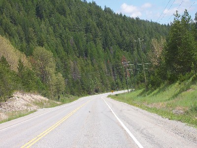
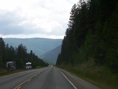
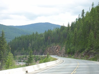
Driving west on 'The Crows Nest Pass Highway', BC |
| 8.7 14.0 |
City of Sparwood, BC  |
Eastern boundary. Photo is view from highway. Attractions in and around Sparwood, BC: Heritage Murals - Henry Volkman Memorial Leisure Centre - Open pit coal mine tours - World's Largest Dump Truck - Coal Miner Days.
|
| 10.8 17.4 |
Roadside turnout |
Paved with information sign - North side of highway. |
| 11.0 17.7 |
Roadside turnout |
South side of highway. No services available. |
| 12.9 20.8 |
Junction of Highway #43 to Elkford, BC |
Access to Elk Lakes Provincial Park. Wilderness, backcountry or walk-in camping. Camping is permitted in five separate areas, and interesting hiking trails connect Elk Lakes with the adjoining Peter Lougheed Provincial Park in Alberta. Facilities: This park only has pit toilets - no flush toilets - Picnic Areas - Campfires.
|
| 13.2 21.3 |
Community of Sparwood, BC |
Services available - fuel. Access to campground, R.V. park - South side of highway. |
| 14.1 22.7 |
RCMP detachment at Pine Avenue |
North side of highway. |
| 16.9 27.2 |
Roadside turnout |
Paved with historiccal marker - North side of highway. |
| 17.2 27.7 |
Roadside turnout |
Garbage stand. |
| 19.7 31.7 |
Photo View from highway  |
Driving west on 'The Crows Nest Pass Highway', BC |
| 21.1 34.0 |
Roadside turnout |
Rest area, toilets - North side of highway. |
| 23.9 38.5 |
Community of Hosmer, BC |
|
| 24.3 39.1 |
Point of Information |
Crossing Elk River, BC. |
| 24.9 40.1 |
Access to R.V. park, campground |
North side of highway. |
| 30.1 48.4 |
Photo View from highway  |
Welcome to City of Fernie, BC - Dicken Road. Attractions in and around Fernie, BC: Griz Days - Fernie Freeski - Powder Pedal Paddle - Powder 8's - TransRockies
Fernie, BC is the Finish of the Trans Rockies Challenge, one of the toughest Mountain Bike Races in the world -
The Firnie, BC Ghost Rider.
|
| 30.1 48.5 |
BC Visitor Information Center |
North side of highway. |
| 30.6 49.2 |
Point of Information |
Crossing Elk River, BC. The BC; Elk River begins at the lakes in Elk Lakes Provincial Park near the Alberta/British Columbia border. It flows southwest past the communities of Elkford,BC, Sparwood, BC and Fernie, BC; eventually flowing into Lake Koocanusa. |
| 31.4 50.6 |
Services at highway |
Fuel, diesel. |
| 32.4 52.1 |
Access to city center of Fernie |
|
| 32.4 52.2 |
Point of Information |
Crossing Elk River. |
| 33.9 54.5 |
Access to Mount Fernie Provincial Park |
North side of highway. Mount Fernie Provincial Park: Total Number of Vehicle Accessible Campsites: 40 - Facilities: Picnic Areas; This park has a day-use/picnic area - Drinking Water - Campfires.
|
| 35.5 57.2 |
Access to Fernie Ski Area |
North side of highway. |
| 35.7 57.5 |
Roadside turnout |
Paved and gravel with scenic lookout towards Elk River. |
| 40.9 65.8 |
Access to lodging |
South side of highway. |
| 42.1 67.8 |
Roadside turnout |
Gravel with garbage stand and scenic lookout - South side of highway. |
| 43.0 69.2 |
Roadside turnout |
Gravel - both sides of highway. |
| 44.0 70.8 |
Roadside turnout |
South side of highway. |
| 44.1 71.0 |
Photo View from highway  |
Driving west on 'The Crows Nest Pass Highway', BC |
| 46.0 74.0 |
Photo View from highway  |
Driving west on 'The Crows Nest Pass Highway', BC |
| 46.9 75.4 |
Roadside turnout |
Gravel, no other services. |
| 48.2 77.5 |
Roadside turnout |
Information sign and garbage stand - South side of highway. |
| 48.5 78.0 |
Roadside turnout |
Paved with garbage stand - South side of highway. |
| 49.1 79.0 |
Access to campground |
North side of highway. |
| 49.4 79.5 |
Access to R.V. park campground |
North side of highway. |
| 51.0 82.0 |
Community of Elko |
|
| 51.5 82.9 |
Junction of Highway #93 |
South to community of Grasmere, Rooseville. NOTE: For highway travel north or south via British Columbia Highway #93 - See Milebymile.com Highway #93 Road Map Highway Travel Guide - Cranbrook, BC to US/Canada Border for highway driving directions.
|
| 52.8 85.0 |
Access to Kikomun Creek Provincial Park |
West of highway. Kikomun Creek Provincial Park is located on Lake Koocanusa, a 144 km long reservoir created by the Libby Dam on the Kootenay River in Montana.
Campground Facilities: Total Number of Vehicle Accessible Campsites: 105 - Group Camping - Picnic Areas - Boat Launch - Campfires - Drinking Water - Pit or Flush Toilets - Playground - Sani-Station/Dump.
|
| 53.4 86.0 |
Photo View from highway  |
Access to roadside turnout rest area. Driving west on 'The Crows Nest Pass Highway', BC |
| 55.5 89.3 |
Access to toilets, picnic tables |
|
| 58.1 93.5 |
Photo View from highway  |
Driving west on 'The Crows Nest Pass Highway', BC. |
| 59.0 95.0 |
Access to community of Galloway, BC. |
|
| 60.9 98.0 |
 |
Welcome to community of Jaffray - Eastern boundary. |
| 61.5 99.0 |
Access to R.V. park campground |
South side of highway. |
| 62.5 100.5 |
Point of Information |
Crossing Little Sand Creek. |
| 62.8 101.0 |
Services at highway |
Fuel, diesel - South side of highway. |
| 63.1 101.5 |
Access to B&B |
South side of highway. Bayness Lake Road. |
| 65.2 105.0 |
Roadside turnout |
Gravel - North side of highway. |
| 65.3 105.1 |
Photo View from highway  |
Driving west on 'The Crows Nest Pass Highway', BC |
| 66.2 106.6 |
Large roadside turnout |
Garbage stand - South side of highway. |
| 69.4 111.7 |
Access to Kootenay Trout Hatchery |
8 kms. THe Kootenay Trout Hatchery hatchery is the 2nd largest in the province of British Columbia. There is a extensive interpretive area with educational models and interactive displays available for free self-guided tours daily. |
| 69.4 111.7 |
Access to Norbury Lake Provincial Park |
15 kms. Norbury Lake Provincial Park total Number of Vehicle Accessible Campsites: 46 -Facilities: Picnic Areas - Drinking Water - Campfires - Boat Launch.
|
| 69.5 111.8 |
Photo View from highway  |
Driving west on 'The Crows Nest Pass Highway', BC |
| 69.7 112.2 |
Photo View from highway  |
Driving west on 'The Crows Nest Pass Highway', BC |
| 69.8 112.4 |
Point of Information - Crossing Kootenay River, BC. |
Driving west on 'The Crows Nest Pass Highway', BC |
| 70.2 113.0 |
Access to community of Wardner, BC |
2 kms South. |
| 73.2 117.8 |
Photo View from highway - Looking at Kootenay River, BC |
Driving west on 'The Crows Nest Pass Highway', BC |
| 75.0 120.7 |
Roadside turnout |
Paved, garbage stand with scenic lookout and historical marker - North side of highway. |
| 83.1 133.7 |
Roadside turnout rest area |
Toilets, picnic tables - South side of highway. |
| 85.1 137.0 |
Large roadside turnout |
Paved with garbage stand and information sign - North side of highway. |
| 85.3 137.3 |
Junction of Highway 93 North and 95 North |
North to Fort Steele, Invermere, and Radium Hot Springs. NOTE: For highway travel via British Columbia Highway #95 See - Milebymile.com Road Map Highway Travel Guide BC Highway #95 - Cranbrook, BC to Creston, BC for highway driving directions
|
| 86.8 139.7 |
Roadside turnout |
Garbage stand. |
| 88.2 142.0 |
Roadside turnout |
Paved with garbage stand and information sign - North side of highway. |
| 88.7 142.8 |
Access to Highway 95A to Kimberley |
Access to airport. At this point, highway overlaps with Highway 95. |
| 88.9 143.0 |
View from Highway |
Welcome to City of Cranbrook, BC. Attractions in and around Cranbrook, BC: Heritage Walking Tour - Wildlife Education Centre - St. Eugene Mission - Aasland Museum Taxidermy - Kootenay Trout Hatchery - Cranbrook, Canadian Museum of Rail Travel - Fort Steele Heritage Town. |
| 89.5 144.0 |
Access to Cranbrook Chamber of Commerce |
Visitor information center - North side of highway. |
| 89.9 144.7 |
Little Brook Drive |
|
| 90.1 145.0 |
All services available at highway. |
|
| 90.7 146.0 |
#6 Feet North. |
|
| 91.0 146.5 |
Cranbrook business area |
Access to city center - South side of highway. |
| 91.4 147.1 |
King Street |
Access to city center - South side of highway. |
| 92.2 148.3 |
Services at highway |
Fuel, diesel - North side of highway. |
| 92.6 149.0 |
Access to visitor information center |
South side of highway. |
| 92.7 149.2 |
Jim Smith Lake |
|
| 92.9 149.5 |
Jim Smith Lake Provincial Park and campground |
North side of highway. Jim Smith Lake Provincial Park - Total Number of Vehicle Accessible Campsites: 28 Facilities: Vehicle Accessible Camping - Pit or Flush Toilets - Picnic Areas - Drinking Water - Campfires - Boat Launch.
|
| 100.4 161.5 |
Photo View from highway  |
Driving west on 'The Crows Nest Pass Highway', BC |
| 101.0 162.5 |
Roadside turnout |
Paved with garbage stands - North side of highway. |
| 102.3 164.6 |
Point of Information |
Crossing Moyie River. The Moyie River is a tributary of the Kootenai River. The Moyie River is part of the Columbia River basin, being a tributary of the Kootenay River, which is tributary to the Columbia River.
|
| 102.5 165.0 |
Access to campground |
|
| 103.3 166.2 |
Moyie Lake Provincial Park |
North side of highway.Moyie Lake Provincial Park total Number of Vehicle Accessible Campsites: 111 - Facilities: Showers - Pit or Flush Toilets - Picnic Areas - Drinking Water - Campfires - Boat Launch - Sani-Station/Dump.
|
| 103.3 166.2 |
Point of information - Crossing Moyie River. |
Driving west on 'The Crows Nest Pass Highway', BC |
| 104.9 168.8 |
Photo View from highway  |
Driving west on 'The Crows Nest Pass Highway', BC |
| 105.4 169.6 |
Photo View from highway - Looking at Moyie Lake, BC  |
Driving west on 'The Crows Nest Pass Highway', BC |
| 107.7 173.3 |
Roadside turnout |
Paved with garbage stand and viewpoint area - North side of highway. |
| 110.5 177.8 |
Community of Moyie, BC |
Moyie, BC is situated on the eastern shore of lower Moyie Lake. Attractions in and around Moyie, BC - Moyie High House Museum. - St. Peter's Catholic Church.
|
| 110.9 178.4 |
Services at highway |
Fuel - South side of highway. |
| 110.9 178.4 |
Kootenay Trail and Moyie |
Kootenay gold discoveries attracted thousands of prospectives from Washington Territory in late 1850's and 1860's. In those years all trails led South into Washington, Idaho and vast bulk of treasures and commerce enriched these areas. The need for an all British Route to business area of province was realized when Eggert Doodenay was commissioned to extend this famous trail East from Rock Creek. By 1865 this historic trail was completed. Although it follows the shores of this lake, it was not until 1883 that the town of Moyie came into being, after a magnificent body of silver orr was discovered. Today the Doodenay Trail has all but vanished but Moyie lives on. |
| 112.7 181.4 |
Access to R.V. park and campground |
North side of highway. |
| 113.1 182.0 |
Point of Information |
Crossing Moyie River. |
| 115.0 185.0 |
Large roadside turnout |
Gravel, garbage stand, no other services - South side of highway. |
| 116.2 187.0 |
Photo View from highway  |
Driving west on 'The Crows Nest Pass Highway', BC |
| 116.9 188.1 |
Roadside turnout |
Gravel with garbage stand - South side of highway. |
| 118.4 190.5 |
Roadside turnout |
Gravel with garbage stand - South side of highway. |
| 118.4 190.6 |
Photo View from highway  |
Driving west on 'The Crows Nest Pass Highway', BC |
| 120.4 193.7 |
Roadside turnout |
Gravel with garbage stand - North side of highway. |
| 121.8 196.0 |
Point of Information |
Time/zone change. Traffic driving West moves clocks back 1 hour. Those driving East move clocks ahead 1 hour. |
| 122.5 197.2 |
Point of information |
Crossing Irish Man Creek. |
| 122.7 197.4 |
Kooteny Forest District |
Eastern boundary. |
| 123.0 198.0 |
Photo View from highway  |
Driving west on 'The Crows Nest Pass Highway', BC |
| 126.0 202.8 |
Roadside turnout |
Rest area, toilets, picnic area - North side of highway. Point of Information - Crossing Moyie River. |
| 127.0 204.3 |
Roadside turnout |
Paved with garbage stand - South side of highway. |
| 130.5 210.0 |
Community of Yahk, BC |
Eastern boundary. |
| 130.7 210.3 |
Point of Information |
Crossing Moyie River. |
| 130.8 210.5 |
Photo View from highway  |
Driving west on 'The Crows Nest Pass Highway', BC |
| 131.0 210.8 |
Access to lodging |
Town of Yaak - South side of highway. |
| 131.1 211.0 |
Access to Yaak Provincial Park |
South side of highway. |
| 132.2 212.8 |
Roadside turnout |
Paved with garbage stands - North side of highway. |
| 133.0 214.0 |
Point of Information |
Crossing Moyie River. |
| 133.4 214.7 |
Highway #95 leaves Highway #3 at this point. |
|
| 133.5 214.8 |
Point of Information |
Crossing Moyie River. |
| 133.6 215.0 |
Photo View from highway  |
Driving west on 'The Crows Nest Pass Highway', BC |
| 134.6 216.6 |
Roadside turnout |
Paved with garbage stand. |
| 136.3 219.4 |
Roadside turnout |
South side of highway. |
| 138.6 223.0 |
Roadside highway turnout - Rest Area |
Driving west on 'The Crows Nest Pass Highway' BC |
| 142.1 228.7 |
Point of Information |
Crossing Kidd Creek. |
| 142.2 228.8 |
Rest area |
Toilets, picnic tables - North side of highway. |
| 144.8 233.0 |
Access to R.V. park |
South side of highway. |
| 145.1 233.5 |
Point of Information |
Crossing Meadow Creek. Access to B&B. Motorcycle access. |
| 145.7 234.5 |
Photo View from highway  |
Driving west on 'The Crows Nest Pass Highway' BC |
| 148.2 238.5 |
Point of Information |
Crossing Goat River. |
| 150.8 242.7 |
Community of Erickson, BC |
Eastern boundary. Photo is view from highway. |
| 150.8 242.7 |
Point of Information |
Crossing Arrow Creek. |
| 154.2 248.2 |
Access to B&B |
South side of highway. |
| 154.8 249.1 |
Access to R.V. park |
South side of highway. |
| 155.4 250.0 |
Welcome to city of Creston, BC |
Incorporated 1924. Attractions in and around Creston, BC - Creston & District Museum and Archives - Wayside Gardens and Arboretum - Creston Valley Wildlife Management Area and Interpretive Centre - The Columbia Brewing Company, home to Kokanee Beer - Kootenay Candle Factory - Blossom Festival - Apple Festival |
| 155.8 250.7 |
Photo View from highway  |
Business area of Creston, BC. |
| 155.9 250.9 |
Access to U.S. border crossing |
|
| 156.3 251.5 |
 |
Heritage building, community of Creston. |
| 157.3 253.2 |
Access to R.V. park |
North side of highway. Junction of Highway #3A. North to communities of Wynndel, Sirdar and Kuskonook. End of highway travel guide. For continuance of highway #3 west, 'The Crows Nest Pass Highway - See Milebymile.com Road Map Highway Travel Guide BC Highway #3 Creston, BC to Osoyoos, BC for highway driving directions. -e
|