| Miles Kms | Item | Summary |
|---|---|---|
| 0.0 0.0 |
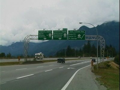
Start of Highway #3 near city of Hope, BC. |
Hope has many basic services. Attractions in and around Hope, BC - Hope Museum - Hope Slide - Othello Tunnels; Located in the Coquihalla Canyon Provincial Park - Hope Arts Gallery - Doc's Canadian Trail Carving Gallery. Access to British Columbia Highway #1 'The Trans Canada Highway' - NOTE: For highway travel via the 'Trans Canada Highway - See Milebymile.com Road Map Highway Travel Guide - BC Highway #1 Trans Canada Highway - Vancouver, BC to Kamloops, BC. for highway driving directions. |
| 1.3 2.1 |
Hope, BC Exit #173 |
|
| 4.3 7.0 |
Hope, BC Exit #177 |
|
| 4.8 7.7 |
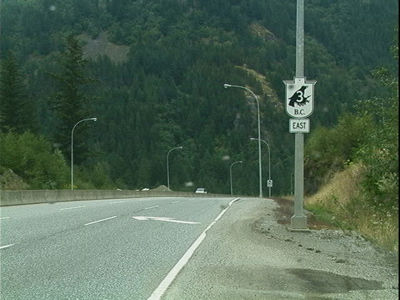
View from Highway - Driving east on BC Highway #3 'The Crows Nest Pass' Highway |
#3 Highway turns shortly before this and becomes just highway #3. The Crows Nest Pass, at an elevation of 1,358 m is a high mountain pass across the Continental Divide of the Canadian Rockies on the border of Alberta/British Columbia. Located in southeast British Columbia and southwest Albert, the Crows Nest Pass is the southernmost rail and highway route through the Canadian Rockies.
|
| 5.3 8.5 |
Nicolum River Provincial Park |
This is a very small park with only nine campsites, so it fills quite quickly. There is a small day-use/picnicking area with picnic tables and parking area. Fishing. NOTE: The parks web site 2008, states (This park is closed indefinately.)
|
| 6.9 11.1 |
Berkey Creek, BC |
|
| 11.4 18.3 |
Roadside Highway Turnout - Hope Slide Rest Area |
Visit the historic Hope Slide. Two interpretive signs tell of the story of the massive Hope rock slide. The Hope Slide was one of the largest landslides ever recorded in Canada. |
| 12.4 20.0 |
Highway Photo |
While driving east on British Columbis Highway #3 'The Crows Nest Pass Highway' |
| 13.4 21.6 |
Sunshine Valley Hamlet |
|
| 15.4 24.8 |
Sumallo Lodge & Restaurant |
604-869-9669 Accomodation, gas, and food. |
| 15.7 25.3 |
Western Entrance of Manning Provincial Park |
'West Gate Portal offers picnicking, day use facilities and hiking. |
| 17.6 28.3 |
'Engineers Road' Historical Marker Pull Out and short hike |
By a gravel pull out, is an abandoned road built in 1861 to take miners to the gold rush of Rock Creek. |
| 18.0 28.9 |
Scenic Pull Out - 'Sumallo River' BC |
As the highway travels alongside the Sumallo River. Stop at one of many beautiful pull outs. Sometimes one will see flyfishers trying to catch trout. |
| 21.6 34.7 |
Sumallo Grove Interpretive Trail |
Trail walks and rest area. |
| 22.5 36.2 |
'Rhododendron Flats' Interpretive Walk |
A short trail wind through vegetation decidedly coastal. The trail's principal attraction is the rare and lovely shrub, the Red Rhododendron, which blooms in great profusion in mid June. |
| 24.4 39.3 |
Highway Photo |
While driving east on British Columbis Highway #3 'The Crows Nest Pass Highway' |
| 27.0 43.5 |
'Cayuse Flats' Trail Head |
Hiking |
| 32.6 52.5 |
Highway Photo |
While driving east on British Columbis Highway #3 'The Crows Nest Pass Highway' |
| 37.0 59.6 |
Allison Pass Summit |
Summit elevation is 1342 metres. |
| 38.8 62.4 |
Similkameen River Pull Out |
Another lovely spot alongside the Similkameen River. Dolly Varden, rainbow and cutthroat trout can be found at the Similkameen and Sumallo Rivers. Highway 3 runs alongside both rivers as it journeys through the park, so keep a lookout for good casting spots.
|
| 39.6 63.7 |
Cambie Creek Recreation Area |
Cross Country Ski area. Cambie Creek is headwaters for the Similkameen River. |
| 41.3 66.4 |
Coldspring Camp Ground |
Tent/Trailer camping, picnic area. Total Number of Vehicle Accessible Campsites: 64. |
| 42.3 68.0 |
Gibson Pass Ski Area |
Downhill & Cross Country Skiing |
| 42.3 68.0 |
Manning Park Resort |
Lodging, Hiking, food, downhill skiing, cross country skiing, |
| 42.4 68.3 |
'Lightning Lake Campground' - turn off |
Turn off to Lightning Lake. Lightning Lake Campground has tent/trailer camping, picnic area, and swimming. Total Number of Vehicle Accessible Campsites: 143. |
| 42.5 68.4 |
'Cascade Look Out' turn off |
8km from the highway turn off |
| 42.5 68.4 |
'Sub Alpine Meadows' turn off |
Explore the sub alpine meadows just 15 km off the highway. In the Spring and early Summer feast your eyes on the abundance of sub-alpine flowers. |
| 42.7 68.7 |
Manning Provincial Park Visitors Centre |
Tourist information, toilets, sewage dump. |
| 43.6 70.1 |
Beaver Pond Trail head |
hiking |
| 44.9 72.2 |
Monuments Trail Head |
Hiking, and Horse Trails |
| 44.9 72.2 |
Boyde's Meadow Recreation Area |
|
| 45.6 73.4 |
'Blow Down' Picnic Area |
A very scenic place to stop for lunch. Find out why this picnic area has such a strange name. |
| 45.6 73.4 |
Hampton Campground |
tent/trailer camping |
| 47.0 75.7 |
View from Highway |
While driving east on British Columbis Highway #3 'The Crows Nest Pass Highway' |
| 48.5 78.1 |
Mule Deer Camp Ground |
Total Number of Vehicle Accessible Campsites: 49. |
| 50.1 80.6 |
View from Highway |
While driving east on British Columbis Highway #3 'The Crows Nest Pass Highway' |
| 52.3 84.2 |
East Gate Village |
A small village where there is gas, food, and other basic amenities. |
| 52.3 84.2 |
East Gate Village |
Service Station & food |
| 52.7 84.8 |
East Gate: Manning Provincial Park |
The east entrance to the park is guarded by a wood carved sculpture of a large black bear. Camping facilities in Manning Provincial Park: Camping. This park offers vehicle accessible campsites.There are four summer drive-in campgrounds with a total of 355 sites. - Showers - Pit or Flush Toilets - Picnic Areas - Group Camping - Drinking Water - Campfire - Cabins / Huts / Yurts - Boat Launch - Sani-Station/Dump.
|
| 63.4 102.1 |
Sunday Summit |
Elevation 1282m. |
| 73.0 117.4 |
Lakeside Camping & R.V. Lots |
|
| 73.0 117.4 |
Kennedy Lake Campsite |
Tent/Trailers, fishing, water,washrooms,showers, sani-station |
| 73.2 117.8 |
Rest Area |
Rest Area and toilets |
| 76.9 123.7 |
Paradise Ranch |
Trail Rides |
| 83.5 134.3 |
Rainbow over the town of Princeton, BC |
Entering the township of Princton, BC. The town was named 'Prince Town' in honour of the Prince of Wales who visited Canada in 1860. 'Prince Town' eventually came to be known as Princeton.
|
| 85.3 137.3 |
AOK Campground |
|
| 87.0 140.0 |
Princeton RV Campground |
partial hookups, hot/cold water,toilets,showers,sani-station, phone |
| 88.4 142.2 |
Princeton Golf Club |
Public Course 9 hole/par36 |
| 88.9 143.1 |
View from Highway |
While driving east on British Columbis Highway #3 'The Crows Nest Pass Highway' |
| 93.7 150.8 |
View from Highway |
While driving east on British Columbis Highway #3 'The Crows Nest Pass Highway' |
| 99.3 159.8 |
Bromley Rock Provincal Park |
Camping, tenting, picnicking, fishing, wheelchair access |
| 102.7 165.3 |
Nendicks Campsite |
hookups,fishing, swimming, showers, phone |
| 104.0 167.3 |
Whistle Stop Campground |
full/partial hookups, grassed shaded sites, free showers, laundry, sani-station, picnicking , wheelchair accessible. |
| 104.0 167.4 |
Waterfall Cabins and Campground |
|
| 106.6 171.5 |
Stemwinder Provincial Park |
Camping, Tenting, fishing, wheelchair access. This park offers 27 vehicle accessible campsites, including one pull-through site. Facilities: Pit or Flush Toilets - Group Camping - Drinking Water - Campfires.
|
| 107.3 172.7 |
River Haven RV Campground |
|
| 109.4 176.0 |
Stop of Interest |
While driving east on British Columbis Highway #3 'The Crows Nest Pass Highway' |
| 109.9 176.8 |
Town of Hedley, BC |
'Famous for gold' Neat little old mining town. Hedley, BC, was made famous by the discovery of gold in 1897, Hedley became one of the great names in Canadian gold mining history. Attractions - Hedley Heritage Society - Interpretive center - Stamp Mill Day. |
| 114.5 184.2 |
Cluckchuway Indian Reservation |
|
| 121.1 194.9 |
View from Highway |
While driving east on British Columbis Highway #3 'The Crows Nest Pass Highway' |
| 122.3 196.8 |
Wildlife Viewing Pull Out |
Occasionally visitors can see mountain goats grazing on the mountain sides at this pull out. |
| 125.2 201.5 |
Rest Area |
|
| 125.6 202.2 |
Cathedral Provincial Park |
Camping, tenting, picnic area, hiking. Cathedral Park comprises an expanse of jagged mountain peaks, azure lakes and flower-dappled alpine meadows. This park offers limited vehicle accessible campsites. Facilities: Pit or Flush Toilets - Picnic Areas - Campfires - Walk-In/Wilderness Camping.
|
| 125.8 202.5 |
Ashola Campground |
|
| 126.3 203.3 |
Eagle Campground |
full hookups, sani-station, pull throughs,tenting,all services |
| 128.1 206.2 |
Town of Keremeos, BC |
Keremeos is on the Similkameen River at the junction of Highway 3 and 3A. Attractions in and around Keremeos, BC - Keremeos Museum - The Similkameen Pow Wow - The Keremeos Elks Rodeo - Chopaka Rodeo - Similkameen Sizzle - The restored Grist Mill. - NOTE: For highway travel via British Columbia Highway #3a See Milebymile Road Map Highway Travel Guide BC Highway #3a Keremeos, BC to Penticton, BC, for highway driving directions. -e
|